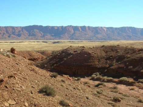
The Vermilion Cliffs National Monument
In the far north of Arizona, The Vermilion Cliffs National Monument provide the most visible feature in one of the five new BLM-administered national monuments that were established in 2000. Like the others, the Vermilion Cliffs National Monument is marked only by a few signposts and is likely to remain without any particular visitor facilities or other improvements – this is a place for people to explore by themselves, though still most tourists zip by on US 89 or US 89A, en route between Zion National Park, the Grand Canyon and Lake Powell, without stopping in this scenic region.

The Vermilion Cliffs National Monument
Much of the area is an isolated plateau, flat and sandy, with just a few scattered ranches and occasional 12th century Anasazi remains – known as the Sand Hills, access is very limited and there are no obvious attractions here. The most interesting parts are the edges, as at the top is the Buckskin Gulch, the longest slot canyon in the Southwest, followed by the lower Paria River Gorge, a deep, watery canyon that rivals any in the much more famous Zion National Park. The west edge of the plateau is formed by a long ridge of eroded, upturned strata (the Coxcomb) which has much colorful, weathered rock formations including ‘The Wave’, while the south and east edges are formed by the Vermilion Cliffs themselves, which must be one of the most spectacular and extensive cliff faces in the US – unusually colorful because of the especially variegated Chinle Formation that forms the lower strata, the escarpment runs for over 30 miles and reaches heights of 2,000 feet. Further to the southeast, the land is quite flat for 100 miles or more though is split by the Colorado River, at the start of its Grand Canyon.